CHARAKTERYSTYKA TRASY

Komentarze
NA TEJ TRASIE PRZYDA CI SIĘ MAPA Z NASZEJ APLIKACJI
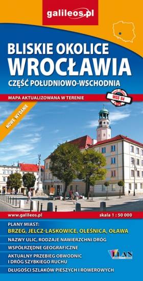
Map in detailed scale range: Wrocław city center to the west, Brzeg to the east, Wiązów to the south, Oleśnica to the north. A lot of information useful for tourists is marked on the map: monuments, accomodation facilities, protected areas, cycling and walking trails, as well as street names and the type of road surface.
The Stobrawa Landscape Park is a protected area in south-western Poland, in te Opole Voivodeship. Map range: Turawa lake to the south-east, Wołczyn to the north, Brzeg to the east. A lot of information useful for tourists is marked on the map, e.g. monuments, wayside shrines, natural monuments and protected areas.
The map covers part of the Lower Silesian Voivodeship in Poland: the area of Nysa city and surrounding municipalities. Lot of information useful for tourists is marked on the map: monuments, accomodation facilities, protected areas, cycling, walking, and canoeing trails. The most interesting places are highlighted with a yellow frame.

Turistická mapa Euroregionu Praděd zahrnuje území česko-polského příhraničí: na české straně okresy Jeseník a Bruntál, na polské straně Opolské vojvodství. Speciálně zpracovaný kartografický podklad obsahuje nezbytné informace pro aktivní turistiku v přeshraniční oblasti: pěší, jezdecké, cyklistické stezky a další významné objekty infrastruktury cestovního ruchu.
Mapa byla zpracována v rámci projektu „E-bike moderní turistika" spolufinancovaného z prostředků Evropského fondu pro regionální rozvoj a ze státního rozpočtu. „Překračujeme hranice"