category-icon

Żukiem Przez Świat - Afryka 2014

9224 km
0 m
Wrocław
0 m2304 km4608 km6912 km9217 km0 m50 m100 m

CHARAKTERYSTYKA TRASY

2014-09-12
Wrocław
category-icon
9224 km
0 m
0 m
3.1/6
Trasę poleca:PolakPotrafi.pl
PolakPotrafi.pl

Komentarze

NA TEJ TRASIE PRZYDA CI SIĘ MAPA Z NASZEJ APLIKACJI
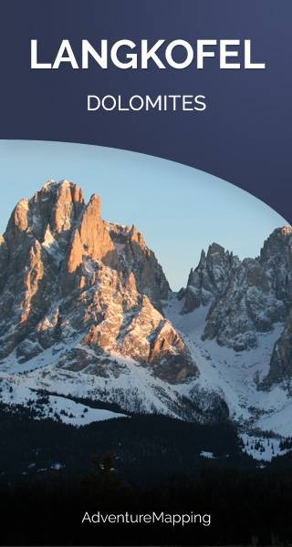
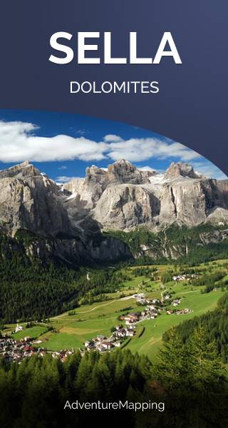
Świętochłowice. Plan miasta
MAPA TURYSTYCZNA W APLIKACJI TRASEO
Świętochłowice. Plan miasta

Plan Świętochłowic – skala 1: 9 000 ze spisem ulic. Plan aktualizowany w terenie. Na planie zaznaczono między innymi rodzaje nawierzchni dróg, szkoły, numeracje posesji. Plan obejmuje miasto w granicach administracyjnych. 

Langkofel
MAPA TURYSTYCZNA W APLIKACJI TRASEO
Langkofel
The Langkofel (3,181m) is the highest mountain of the Langkofel Group in the Dolomites in South Tyrol, Italy. The name translates to "long peak". It stands over the Ladin community of Val Gardena.
Sella Group
MAPA TURYSTYCZNA W APLIKACJI TRASEO
Sella Group

The Sella group is a plateau-shaped massif in the Dolomites mountains of northern Italy. The Sella lies north of the Marmolada and to the east of the Langkofel. The highest peak is Piz Boè at 3,151 m above sea level. The Sella lies between the four Ladin valleys of Badia, Gherdëina, Fascia, and Fodom and is divided between the provinces of South Tyrol, Trentino and Belluno. It can be driven around by car crossing the Campolongo Pass, Pordoi Pass, Sella Pass, and Gardena Pass. In winter it is possible to ski around the entire massif by using the Sella Ronda ski lift carousel. (wikipedia.com)

Szczyrk
MAPA TURYSTYCZNA W APLIKACJI TRASEO
Szczyrk

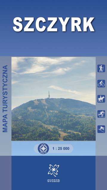
Mapa turystyczna „Szczyrk” obejmuje swoim obszarem gminę Szczyrk, a także częściowo sąsiadujące miejscowości m.in. wschodnią część Brennej, Buczkowice.

Mapa prezentuje szlaki turystyczne z czasami przejść, ścieżki spacerowe i dydaktyczno-przyrodnicze, trasy rowerowe, szlaki konne i narciarskie. Zaznaczone są tu również atrakcje turystyczne, punkty widokowe, schroniska i inne obiekty noclegowe, a także pozostałe informacje niezbędne turyście podczas wędrówek górskich. Mapa zawiera również wyciągi narciarskie wraz z trasami zjazdowymi. Sprawdzi się we wszystkich 4 porach roku!

Cristallo
MAPA TURYSTYCZNA W APLIKACJI TRASEO
Cristallo
Cristallo is a mountain in the Italian Dolomites, northeast of Cortina d'Ampezzo, in the province of Belluno, Veneto, northern Italy. It is a long, indented ridge with four summits higher than 3,000 m. The highest peaks of the Cristallo massif are Monte Cristallo (3,221 m), Piz Popena (3,153 m), Cima di Mezzo (3,154 m), and Cristallino d'Ampezzo (3,008 m). Cima di Mezzo and Cristallino d'Ampezzo can be reached by via ferratas, while Monte Cristallo and Piz Popena both require climbing skills. (wikipedia.com)
Tre Cime di Lavaredo
MAPA TURYSTYCZNA W APLIKACJI TRASEO
Tre Cime di Lavaredo
The Tre Cime di Lavaredo are three distinctive battlement-like peaks, in the Sexten Dolomites of northeastern Italy. They are probably one of the best-known mountain groups in the Alps. They lie on the border between the Italian provinces of South Tyrol and Belluno and are a part of the linguistic boundary between German-speaking and Italian-speaking majorities. The Cima Grande has an elevation of 2999 m. Numerous routes lead from the surrounding communities to and around the peaks. (wikipedia.com)